August 23, 1935-Army Engineers Pioneering in Giant Passamaquoddy Project

The Washington Daily News—Friday—August 23,—1935
Army Engineers Pioneering in Giant Passamaquoddy Project
By Ernie Pyle
NOTE: Here is the first of four stories by our roving reporter, the first on-the-ground reporting of the plans and preparations for the Passamaquoddy tidal power project, greatest of its kind in the world and the only one in America.
EASTPORT, Me.—For years it was all Boulder Dam. When big construction projects were mentioned, Boulder Dam always popped up. The unbelievably vast pile of cement across the Colorado River between Arizona and Nevada was the romantic spot of big construction.
But Boulder Dam is about finished, and something new takes the limelight. It is the Passamaquoddy Bay project, on the wild and rugged northeastern Maine coast, as far away from Boulder Dam as you could get in this country.
Quoddy, as they call it here, is just as romantic as Boulder, probably just as important. I have just been all over the whole scene, by auto, by boat and on foot; one of the very first outside reporters on the spot since work began. And I feel that I caught a little of the spirit of the builders; for there is spirit to this thing already. Creating energy seems to me to come as near solving the pangs of pioneering as anything that can be achieved in this day and age.
● ● ●
First, a little geography, the better to get the picture. The project is, as you may know, a scheme to harness the rise and fall of the tides, and make them produce electricity. This spot was chosen because here, in the Bay of Fundy and its inlets, the tides have the greatest rise and fall of almost any in the world. As much in places as 30 feet!
This is due mainly to the jagged nature of the Maine and New Brunswick coasts. It is not like any coastline you ever saw. I doubt if there is a stretch of straight shore line half a mile long within 100 miles of here. It is all violent indentations, and little bays, and necks of rock jutting out, with hundreds of islands, big and little, lying within the bays themselves and also out just off the coastline.
The result is a complete crazy quilt of land and water, seemingly almost unmappable, and the rising tides are held back by all these hodge-podges of land, until finally they go rushing thru little bottle-necks here and there. That accounts for the great height and power of the tides. It’s the same principle as when you pour a pint of water into a quart bottle, the level of the water will be higher than when you pour a pint into a gallon jar.
● ● ●
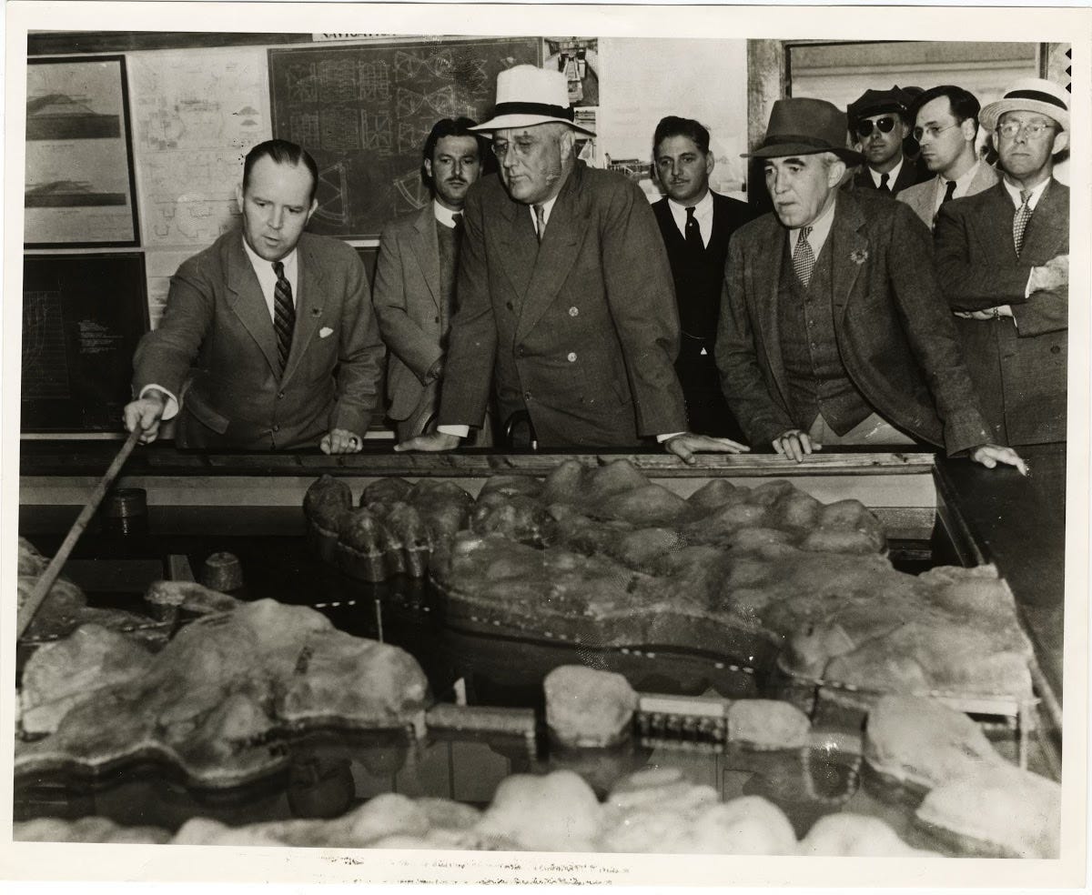
Now for a little history—back in 1920 an American named Dexter P. Cooper, who lives on Campobello Island, saw that by building about half a dozen dams across the various mouths of some of these bays, you could completely cut off the ocean. His idea involved specifically the two bays of Passamaquoddy and Cobscook. Having cut off the bays you could then, by use of flood gates and power houses, control the flow of the tide in and out of these bays, and make it generate electric power.
So he tried to interest utility companies in it. They made surveys, and found the idea feasible, but too expensive. Then he tried to interest the U.S. and Canadian Governments, since half of Passamaquoddy Bay is in Canada. Both governments were interested, but Canada couldn’t afford it, so that was dropped.
Then in 1933 a commission was appointed to study the possibility of doing the job in Cobscook Bay alone, which is all in U.S. territory. The commission reported it could be done. So the job was turned over to the Engineer Corps of the U.S. Army. Money comes from the ERA; labor comes from the relief rolls. And work is now under way.
● ● ●
The only way you can see the Quoddy scene all at once is from an airplane. It covers many, many square miles, and is complicated indeed. But here, try this: Hold your left hand out in front of you, palm inward, fingers open, thumb bent under, and your thumb extended up even with the end of your forefinger. The space between them represents, roughly, Passamaquoddy Bay. The Canadian line runs right down the middle of it.
The space between your forefinger and second finger represents Cobscook Bay, all in U.S. territory, and much smaller than Passamaquoddy. Right out in front of your forefinger, at right angles to it, lies Campobello Island, which has nothing to do with the Quoddy project, but upon which is President Roosevelt’s summer home. It is in Canadian territory, some three miles off shore.
There are other islands too, right in the mouth of the bays and back in the bays themselves.
Eastport, the headquarters of the project, is right on the mid-side of the bay. The town of Lubec is on the end of your forefinger. These two towns, with about 5,000 people, are the biggest in the Quoddy region. You have to drive clear around the end of Cobscook Bay, via the town of Dennysville, to get from one to the other.
They have started work on two dams from the mainland to the islands.
💛 **Enjoyed this post?** Your support helps The Ernie Pyle Legacy Foundation continue to transcribe and promote Ernie’s work. Please click the link below to donate.
https://www.erniepylefoundation.org/home